File:QueenMaudeMountains1.png
Revision as of 08:41, 17 January 2019 by Westarctica (talk | contribs)
No higher resolution available.
QueenMaudeMountains1.png (763 × 498 pixels, file size: 754 KB, MIME type: image/png)
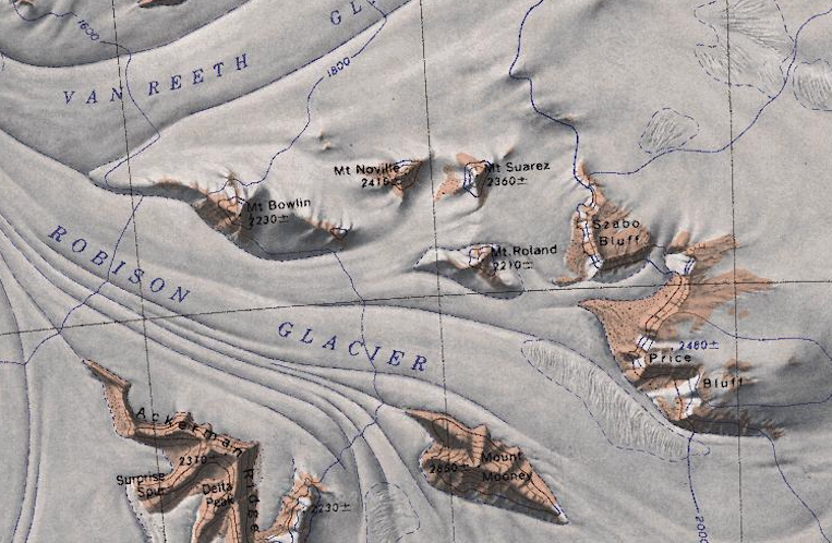
Map showing a cluster of mountains nestled in the Queen Maude Mountains between the Robison and Van Reeth Glaciers.
File history
Click on a date/time to view the file as it appeared at that time.
| Date/Time | Thumbnail | Dimensions | User | Comment | |
|---|---|---|---|---|---|
| current | 08:41, 17 January 2019 | | 763 × 498 (754 KB) | Westarctica (talk | contribs) |
You cannot overwrite this file.
File usage
The following 3 pages use this file: