Difference between revisions of "Nolan Island"
Westarctica (talk | contribs) (added high point info) |
m (coords) |
||
| Line 1: | Line 1: | ||
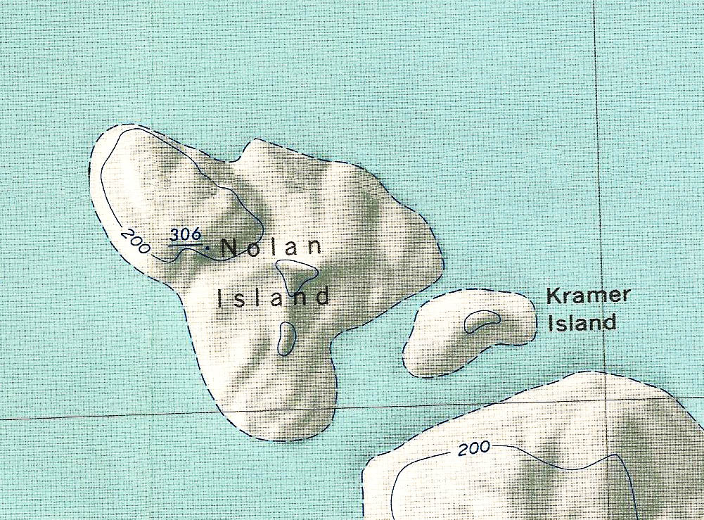
[[File:Nolan Island1.jpg|350px|thumb|Map of Nolan Island]] | [[File:Nolan Island1.jpg|350px|thumb|Map of Nolan Island]] | ||
'''Nolan Island''' is an [[ice]]-covered island 11 kilometers (6 nmi) long, lying 3.7 kilometers (2 nmi) north of Court Ridge in [[Sulzberger Ice Shelf]] in the [[Marshall Archipelago]]. The highest point on the island is an unnamed ridge 306 meters tall. | '''Nolan Island''' (77°13′S, 147°24′W) is an [[ice]]-covered island 11 kilometers (6 nmi) long, lying 3.7 kilometers (2 nmi) north of Court Ridge in [[Sulzberger Ice Shelf]] in the [[Marshall Archipelago]]. The highest point on the island is an unnamed ridge 306 meters tall. | ||
==Discovery and name== | ==Discovery and name== | ||
Revision as of 19:44, 9 January 2021
Nolan Island (77°13′S, 147°24′W) is an ice-covered island 11 kilometers (6 nmi) long, lying 3.7 kilometers (2 nmi) north of Court Ridge in Sulzberger Ice Shelf in the Marshall Archipelago. The highest point on the island is an unnamed ridge 306 meters tall.
Discovery and name
The island was discovered and mapped by the United States Antarctic Service during the 1939–41 research seasons. Nolan Island was named by the Advisory Committee on Antarctic Names in honor of RD1 William G. Nolan, U.S. Navy, who served as a Radarman aboard the USS Glacier during Antarctic expeditions from 1957–58 and 1961–62.
Peerage title
On 29 December 2020, Matteo Ricciardi was granted the peerage title Duke of Nolan in recognition of his support of Westarctica's mission and goals. His title is named for this island.
