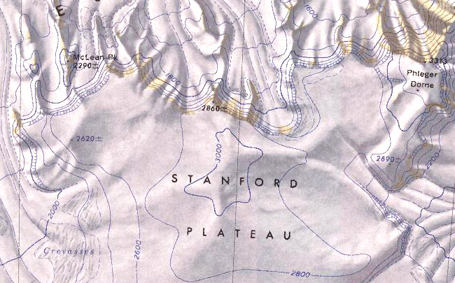
Stanford Plateau
Revision as of 03:37, 22 January 2024 by Westarctica (talk | contribs) (Created page with "350px|thumb|Map of the Stanford Plateau '''Stanford Plateau''' (85°57′S 140°00′W) is an ice-capped plateau, over 3,000 meters (9,800 f...")
Stanford Plateau (85°57′S 140°00′W) is an ice-capped plateau, over 3,000 meters (9,800 ft) high and 15 nautical miles (28 km; 17 mi) wide, between the heads of Leverett and Kansas Glaciers. The plateau unites with the interior ice sheet to the south, but terminates to the north in the Watson Escarpment.
Discovery and name
The plateau was mapped by the US Geological Survey using ground surveys and U.S. Navy air photos collected during the years 1960-63. Stanford Plateau was named by US-ACAN in honor of Stanford University which has sent many researchers to study Antarctica.
Peerage title
On 20 January 2024, Darren Ashford was granted the peerage title Baron Stanford in recognition of his support of Westarctica. His title is named for this feature.
