Tulier Glacier Conservation Area
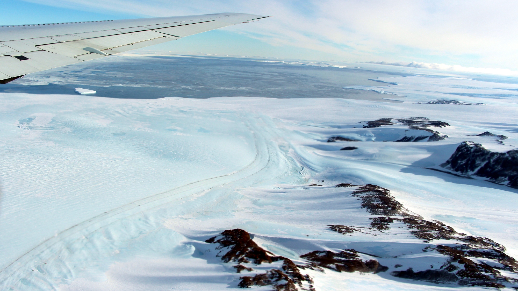
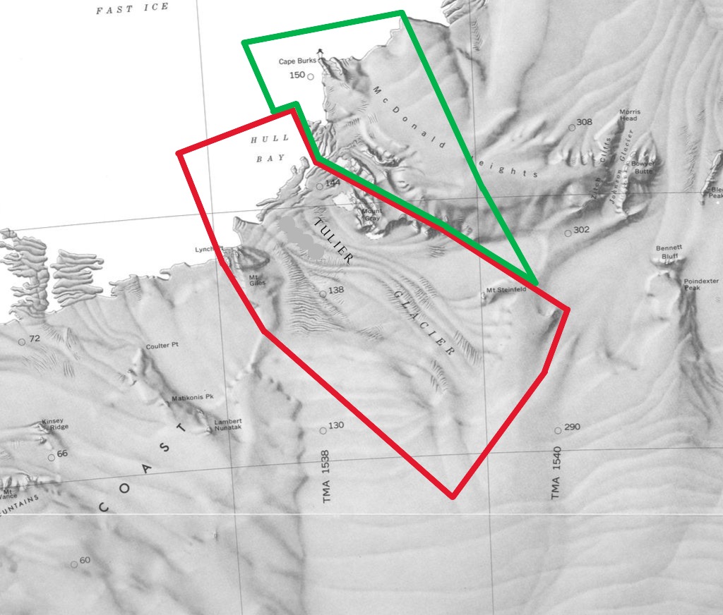
Tulier Glacier Conservation Area (75°5′S 137°15′W) is a protected area of Westarctica created to preserve Tulier Glacier and the surrounding area.. It was created via Royal Decree on 8 August 2025 by Grand Duke Travis. It falls under the oversight of the Westarctican Parks Service.
History
Tulier Glacier was discovered by the United States Antarctic Service (1939–41). On 4 September 2023, the Senate of Westarctica passed Westarctican Ordinance WO-2023-003 which renamed Hull Glacier to the Tulier Glacier, in honor of Luis "Wolf" Tulier, the Duke of Waesche. This was done, in part, to help differentiate it from the adjacent Hull Bay.
Tulier Glacier Conservation Area has been identified as a leading candidate for elevation to the status of national park, possibly via a merger with Cape Burks National Monument.
Conservans Protectorem
Those nobles whose titles were named for features within the memorial when it was established were afforded the additional honorific Conservans Protectorem to use in conjunction with said title. Tulier Glacier Conservation Area granted that honorific to the following:
- Viscount of Frost
- Baron of Hull Bay
Conservation
Tulier Glacier Conservation Area's roughly 599,172 acres (2,425 square kilometers) is protected under category V (protected landscape or seascape) of the International Union for Conservation of Nature. These protections mean that conservation efforts are primarily aimed at the preservation of the geologic and natural landscape. Although not the primary concern, efforts are also made to protect biodiversity found within its boundaries.
During the evaluation process for the glacier's protection, Jordan Farmer was told during a conference call with the glaciology team at Brigham Young University that ice samples from it contained some of the oldest indicators they had seen on the continent. This makes the preservation of the formation more crucial to the nation's scientific endeavors.
Features
The conservation area envelops the entirety of Tulier Glacier, as well as a number of surrounding landscape.
Key locations
- Frost Cliff (75°13′S 135°43′W) is a steep, partly ice-covered cliff 2 nautical miles (4 km) east of Mount Steinfeld, on the south side of the divide between the upper reaches of Tulier Glacier and Kirkpatrick Glacier near Strawn Pass. it was named by the Advisory Committee on Antarctic Names for Commander William L. Frost, U.S. Navy, Officer-in-Charge of Antarctic Support Activities at McMurdo Station in 1970.
- Hull Bay (74°55′S 137°40′W) is an ice-filled bay, about 46 kilometers (25 nmi) wide, fed by the Tulier Glacier, which descends into it between Lynch Point and Cape Burks. The bay was named for U.S. Secretary of State Cordell Hull.
- Kirkpatrick Glacier (75°9′S 136°0′W) is a tributary glacier about 12 nautical miles (22 km) long, flowing west along the south side of the McDonald Heights to enter the east side of Tulier Glacier. It was named by the Advisory Committee on Antarctic Names for Commander Thomas W. Kirkpatrick, United States Coast Guard, Ship Operations Officer, U.S. Naval Support Force, Antarctica, during Operation Deep Freeze 1972 and 1973.
- Lynch Point (775°5′S 137°44′W) is a rocky point at the seaward end of the peninsula between Frostman Glacier and Tulier Glacier. The point was named by the Advisory Committee on Antarctic Names for Ensign William R. Lynch II, U.S. Navy Reserve, Damage Control Officer aboard USS Glacier in exploring these coastal waters, 1961–62.
- Miller Spur (75°7′S 137°29′W) is an ice-covered spur that descends northeast from Mount Giles. The spur terminates in a small rock bluff about 1 nautical mile (2 km) west of lower Tulier Glacier. It was named by the Advisory Committee on Antarctic Names for sailmaker Linwood T. Miller, a member of the Byrd Antarctic Expedition, 1933–35, who produced windproof shirts, parkas, tents and other canvas materials for the expedition.
- Mount Giles (75°9′S 137°37′W) is a mainly snow-covered mountain, 820 meters (2,690 ft) high, located 5 nautical miles (9.3 km; 5.8 mi) south-southeast of Lynch Point. The mountain is the highest elevation on the divide between the seaward ends of Frostman Glacier and Tulier Glacier. It was named in honor of Walter R. Giles, a technical sergeant in the United States Marine Corps (USMC), who worked as a copilot and radio operator on some of the ariel flights which discovered and mapped this region of Antarctica.
- Mount Gray (75°1′S 136°42′W) is a rounded, ice-worn mountain on the southwest part of the McDonald Heights. It stands on the east side of Tulier Glacier, 2 nautical miles (4 km) north of Oehlenschlager Bluff. The mountain was named for Orville Gray, an aviation machinist's mate, and plane captain on these flights.
- Mount Steinfeld (75°12′S 135°51′W) is a mountain (685 m) at the west end of an ice-covered ridge that overlooks the confluence of Tulier Glacier and Kirkpatrick Glacier. Named by Advisory Committee on Antarctic Names (US-ACAN) for Edward F. Steinfeld, Jr., United States Antarctic Research Program (USARP) meteorologist at Byrd Station, 1962.
- Oehlenschlager Bluff (75°3′S 136°42′W) is a steep rock bluff overlooking Tulier Glacier from the north. It marks the southwest extremity of Erickson Bluffs and McDonald Heights. Named by Advisory Committee on Antarctic Names (US-ACAN) for Richard J. Oehlenschlager, member of the biological party that made population studies of seals, whales, and birds in the pack ice of the Bellingshausen and Amundsen Seas using USCGC Southwind and its two helicopters, 1971-72.
- Tulier Glacier (75°5′S 137°15′W) is a glacier, about 35 nautical miles (65 km) long, flowing northwest between Mount Giles and Mount Gray into Hull Bay. It is named in honor of Luis "Wolf" Tulier, the Duke of Waesche, who served as the first Prime Minister of Westarctica.

