Difference between revisions of "Mount Carmer"
Jump to navigation
Jump to search
Westarctica (talk | contribs) (Created page with "350px|thumb|Map of Mount Carmer in Antarctica '''Mount Carmer''' (86°6′S 131°11′W) is a mountain on the east side of Wotkyns Glacier in Anta...") |
(No difference)
|
Revision as of 04:22, 6 May 2024
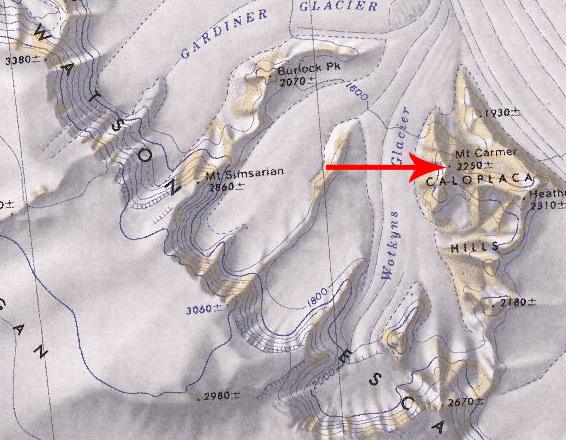
Mount Carmer (86°6′S 131°11′W) is a mountain on the east side of Wotkyns Glacier in Antarctica, standing 2 nautical miles (4 km) west-northwest of Heathcock Peak in the Caloplaca Hills.
Discovery and name
The mountain was mapped by the United States Geological Survey from surveys and from U.S. Navy air photos collected during the years 1960–64. Mount Carmer was named by the Advisory Committee on Antarctic Names in honor of John L. Carmer, an electronics technician who served at Byrd Station in 1962.
