Difference between revisions of "Template:POTD protected"
Jump to navigation
Jump to search
Westarctica (talk | contribs) |
Westarctica (talk | contribs) |
||
| (168 intermediate revisions by the same user not shown) | |||
| Line 1: | Line 1: | ||
{| role="presentation" style="margin:0 3px 3px; width:100%; text-align:left; background-color:transparent; border-collapse: collapse; " | {| role="presentation" style="margin:0 3px 3px; width:100%; text-align:left; background-color:transparent; border-collapse: collapse; " | ||
|style="padding:0 0.9em 0 0;" | [[File: | |style="padding:0 0.9em 0 0;" | [[File:Whitmore Mountains - Mt Chapman.jpg|300px|thumb]] | ||
|style="padding:0 6px 0 0"| | |style="padding:0 6px 0 0"| | ||
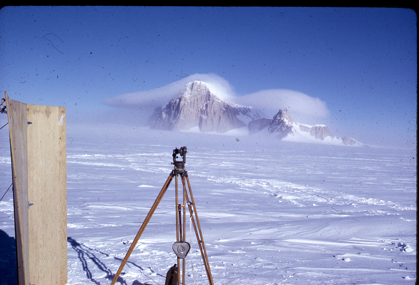
The '''[[Whitmore Mountains]]''' are an isolated mountain range of the Transantarctic Mountains System, located in the [[Marie Byrd Land]] region of [[Westarctica]]. They consist of three small mountains and a cluster of [[nunatak]]s arranged in a semicircular pattern extending over 15 miles. When researching the National Geographic Atlas map of [[Antarctica]], [[Grand Duke Travis]] was inspired by the fact that the Whitmore Mountains were located in the unclaimed section of Marie Byrd Land and they shared the name of his childhood best friend, [[Viscount of Whitmore|Neil Whitmoyer]]. Were it not for this immediate confirmation, it is entirely possible the Grand Duke might not have decided to move forward with his plan to claim Westarctica. | |||
<p><small>Photo credit: U.S. Antarctic Program</small></p> | |||
[[:Category:Images|'''(More Images)''']] | |||
<p><small> | |||
[[:Category:Images|'''(More | |||
<div class="potd-recent" style="text-align:right;"> | <div class="potd-recent" style="text-align:right;"> | ||
Latest revision as of 16:35, 18 April 2025
|
The Whitmore Mountains are an isolated mountain range of the Transantarctic Mountains System, located in the Marie Byrd Land region of Westarctica. They consist of three small mountains and a cluster of nunataks arranged in a semicircular pattern extending over 15 miles. When researching the National Geographic Atlas map of Antarctica, Grand Duke Travis was inspired by the fact that the Whitmore Mountains were located in the unclaimed section of Marie Byrd Land and they shared the name of his childhood best friend, Neil Whitmoyer. Were it not for this immediate confirmation, it is entirely possible the Grand Duke might not have decided to move forward with his plan to claim Westarctica. Photo credit: U.S. Antarctic Program |
