Difference between revisions of "Mount Hartigan"
m (changed Executive Committee Range to McHenry Range) |
(added WPS note) |
||
| Line 13: | Line 13: | ||
* [[Boudette Peaks]] | * [[Boudette Peaks]] | ||
* Tusing Peak | * Tusing Peak | ||
==Protection by the government== | |||
On 20 April 2025, [[Grand Duke Travis]] protected the mountain under the oversight of the [[Westarctican Parks Service]] as part of [[McHenry Range Conservation Zone]]. It was protected in the first group of sites named by the government. | |||
[[Category:Geography of Westarctica]] | [[Category:Geography of Westarctica]] | ||
[[Category:Mountains]] | [[Category:Mountains]] | ||
Revision as of 20:48, 28 April 2025
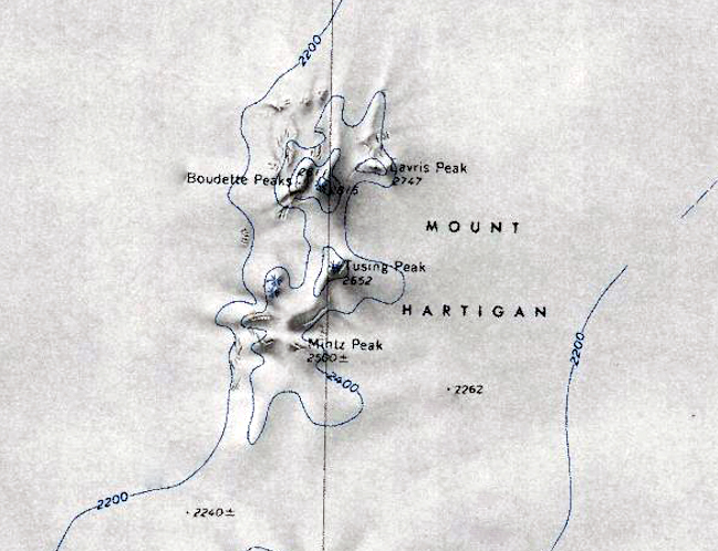
Mount Hartigan is a broad, mostly snow-covered mountain with several individually named peaks which rise up to 2,800 meters.
It is situated immediately north of Mount Sidley in the McHenry Range in Westarctica.
Discovery and name
Mount Hartigan was discovered by the United States Antarctic Service expedition on a flight on 15 December 1940, and named for Rear Admiral Charles C. Hartigan, U.S. Navy, Navy Department member of the Antarctic Service Executive Committee. Admiral Hartigan had previously received the Medal of Honor for actions during the 1914 United States occupation of Veracruz, Mexico.
Features
- Mintz Peak
- Lavris Peak
- Boudette Peaks
- Tusing Peak
Protection by the government
On 20 April 2025, Grand Duke Travis protected the mountain under the oversight of the Westarctican Parks Service as part of McHenry Range Conservation Zone. It was protected in the first group of sites named by the government.

