Difference between revisions of "Haines Mountains"
Westarctica (talk | contribs) |
Westarctica (talk | contribs) |
||
| (One intermediate revision by the same user not shown) | |||
| Line 1: | Line 1: | ||
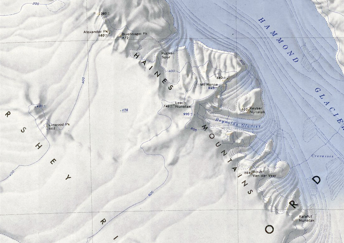
[[File:Haines Mountains.jpg|450px|thumb|Map of the Haines Mountains]] | |||
The '''Haines Mountains''' (77°34'S 146°20'W) are a range of [[ice]]-capped mountains trending northwest–southeast for about 25 miles and forming the southwest wall of the [[Hammond Glacier]] in the [[Ford Ranges]] of [[Westarctica]]. | The '''Haines Mountains''' (77°34'S 146°20'W) are a range of [[ice]]-capped mountains trending northwest–southeast for about 25 miles and forming the southwest wall of the [[Hammond Glacier]] in the [[Ford Ranges]] of [[Westarctica]]. | ||
| Line 6: | Line 7: | ||
==Features== | ==Features== | ||
* [[Leach Nunatak]] | * [[Leach Nunatak]] | ||
* [[Mount Ronne]] | |||
* [[Reynolds Glacier]] | |||
* [[Mount Van der Veer]] | |||
* [[Rucker Spur]] | |||
* [[Alexander Peak]] | |||
* [[Buennagel Peak]] | |||
* [[Keyser Nunatak]] | |||
[[Category:Mountains]] | [[Category:Mountains]] | ||
Latest revision as of 05:21, 29 December 2021
The Haines Mountains (77°34'S 146°20'W) are a range of ice-capped mountains trending northwest–southeast for about 25 miles and forming the southwest wall of the Hammond Glacier in the Ford Ranges of Westarctica.
Discovery and name
The mountains were discovered by the Byrd Antarctic Expedition in 1934. The Haines Mountains were named in honor of William C. Haines, the meteorologist of the Byrd expeditions of 1928–30 and 1933–35.
