Difference between revisions of "Kessens Peak"
Westarctica (talk | contribs) (added map and cleaned up article into sections) |
|||
| (2 intermediate revisions by one other user not shown) | |||
| Line 1: | Line 1: | ||
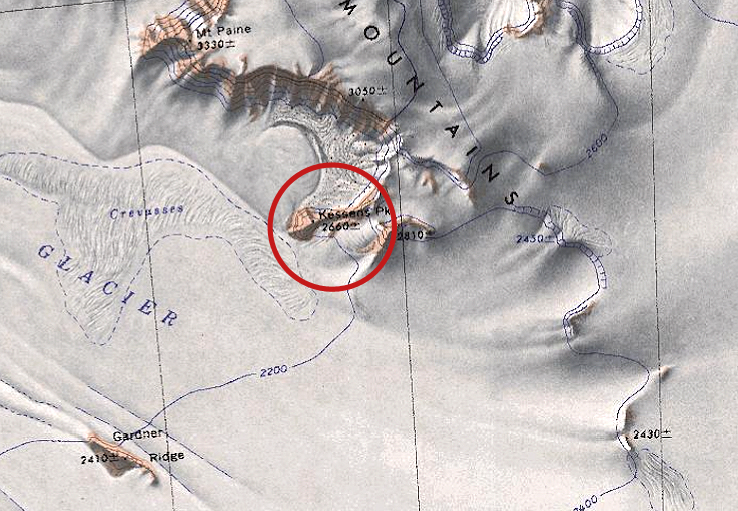
'''Kessens Peak''' (86°51',146°41'W) is a | [[File:Kessens-Peak.jpg|350px|thumb|Map showing the location of Kessens Peak highlighted with a red circle.]] | ||
'''Kessens Peak''' (86°51',146°41'W) is a 2,660 meter high peak located 5 nautical miles southeast of [[Mount Paine]] in the [[La Gorce Mountains]], in [[Westarctica]]. | |||
==Discovery and name== | |||
The peak was mapped by the United States Geological Survey from surveys and [[U.S. Navy]] air photos collected during the years 1960–63. Kessens Peak was named by the Advisory Committee on [[Antarctic]] Names in honor of Gerard R. Kessens of U.S. Navy Squadron VX-6. Kessens served as a photographer during Operation Deep Freeze in 1966 and 1967. | |||
==Peerage title== | |||
On 13 November 2017, Tyler Koenig was granted the [[Peerage of Westarctica|peerage title]] Count of Kessens. | |||
[[Category:Geography of Westarctica]] | [[Category:Geography of Westarctica]] | ||
Latest revision as of 02:50, 13 August 2019
Kessens Peak (86°51',146°41'W) is a 2,660 meter high peak located 5 nautical miles southeast of Mount Paine in the La Gorce Mountains, in Westarctica.
Discovery and name
The peak was mapped by the United States Geological Survey from surveys and U.S. Navy air photos collected during the years 1960–63. Kessens Peak was named by the Advisory Committee on Antarctic Names in honor of Gerard R. Kessens of U.S. Navy Squadron VX-6. Kessens served as a photographer during Operation Deep Freeze in 1966 and 1967.
Peerage title
On 13 November 2017, Tyler Koenig was granted the peerage title Count of Kessens.
