Difference between revisions of "Molar Island"
Westarctica (talk | contribs) (Created page with "400px|thumb|Map showing location of Molar Island '''Molar Island''' is an ice-covered island of irregular shape, 0.25 mile long, between Early...") |
Westarctica (talk | contribs) (added geocords) |
||
| Line 1: | Line 1: | ||
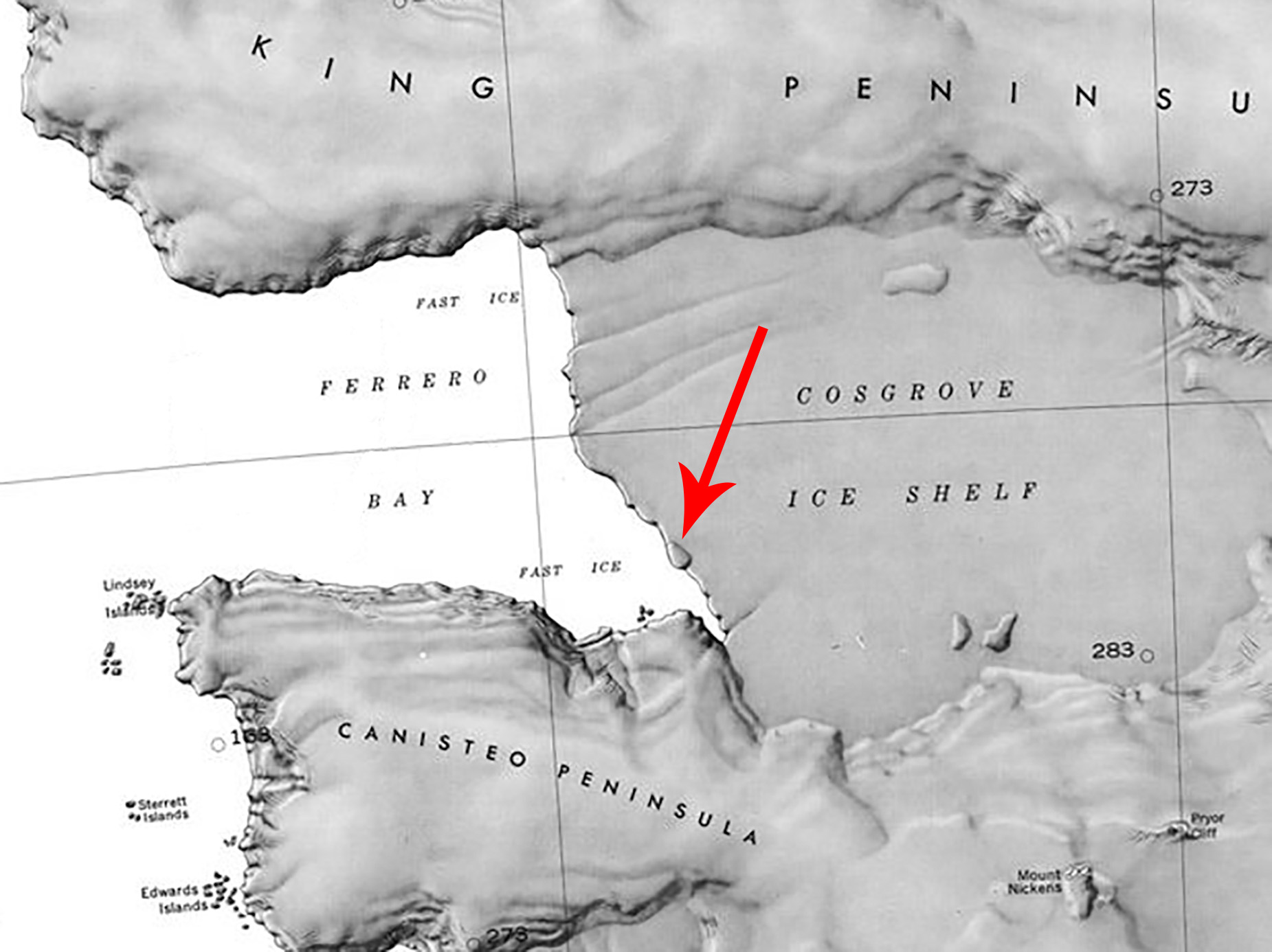
[[File:Molar Island.jpg.jpg|400px|thumb|Map showing location of Molar Island]] | [[File:Molar Island.jpg.jpg|400px|thumb|Map showing location of Molar Island]] | ||
'''Molar Island''' is an ice-covered island of irregular shape, 0.25 mile long, between [[Early Islands]] and the [[Cosgrove Ice Shelf]] in the extreme southeast part of [[Ferrero Bay]] along the [[Eights Coast]]. | '''Molar Island''' (73°40′S 101°22′W) is an ice-covered island of irregular shape, 0.25 mile long, between [[Early Islands]] and the [[Cosgrove Ice Shelf]] in the extreme southeast part of [[Ferrero Bay]] along the [[Eights Coast]]. | ||
==Discovery== | ==Discovery== | ||
Latest revision as of 14:27, 21 June 2024
Molar Island (73°40′S 101°22′W) is an ice-covered island of irregular shape, 0.25 mile long, between Early Islands and the Cosgrove Ice Shelf in the extreme southeast part of Ferrero Bay along the Eights Coast.
Discovery
Prior to the early 2000s, Molar Island was covered by the Cosgrove Ice Shelf. However, climate scientists discovered the island as they were studying the ice shelf's retreat due to deep circumpolar water erosion. The occurrence of open water around the feature, clearly shown in USGS aerial photographs and satellite images of the 1966-2000 period, has drawn attention due to the island's position behind the fast ice of Ferrero Bay.
Name
Molar Island was named descriptively in 2009 by the United States Advisory Committee on Antarctic Names because the shape of the island is reminiscent of a molar tooth.
