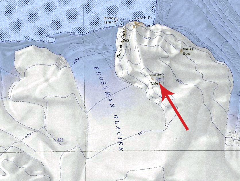
Mount Giles
Mount Giles (75°9′S 137°37′W) is a mainly snow-covered mountain, 820 meters (2,690 ft) high, located 5 nautical miles (9.3 km; 5.8 mi) south-southeast of Lynch Point on the coast of Westarctica. The mountain is the highest elevation on the divide between the seaward ends of Frostman Glacier and Tulier Glacier.
Discovery and name
Mount Giles was discovered on aerial flights from the West Base of the United States Antarctic Service (USAS) in 1940. It was named in honor of Walter R. Giles, a technical sergeant in the United States Marine Corps (USMC), who worked as a copilot and radio operator on some of the ariel flights which discovered and mapped this region of Antarctica.
Location and geology
Mount Giles is the high point of the divide between Frostman Glacier to the west and Tulier Glacier to the east before they enter Hull Bay on the coast of Marie Byrd Land. Other features of the divide include the Konter Cliffs, Lynch Point, and Miller Spur.
The geology of Mount Giles includes layered gabbro holding quartz-free plagioclase, clinopyroxene, and olivine. Isotope analysis of these formations indicates an age of 154±35 million years.
Peerage title
On 12 June 2025, Owen Trott, the Duke of MacAyeal was granted the peerage title Marquis de Giles, which immediately became a subordinate title for His Grace.
Protection by the government
On 8 August 2025, Grand Duke Travis protected the mountain under the oversight of the Westarctican Parks Service as part of Tulier Glacier Conservation Area.
