Difference between revisions of "Cosgrove Ice Shelf"
Jump to navigation
Jump to search
(map) |
Westarctica (talk | contribs) m |
||
| Line 3: | Line 3: | ||
==Discovery and name== | ==Discovery and name== | ||
It was mapped from air photos taken by U.S. Navy Operation Highjump, 1946–47, and named by the Advisory Committee on [[Antarctica|Antarctic]] Names for Lieutenant Jerome R. Cosgrove, U.S. Navy Reserve, assistant communications officer on the staff of the Commander, U.S. Navy Support Force, Antarctica, during U.S. Navy Operation Deep Freeze, 1967 and 1968. | It was mapped from air photos taken by [[U.S. Navy]] Operation Highjump, 1946–47, and named by the Advisory Committee on [[Antarctica|Antarctic]] Names for Lieutenant Jerome R. Cosgrove, U.S. Navy Reserve, assistant communications officer on the staff of the Commander, U.S. Navy Support Force, Antarctica, during U.S. Navy Operation Deep Freeze, 1967 and 1968. | ||
[[Category:Ice Shelves]] | [[Category:Ice Shelves]] | ||
[[Category:Geography of Westarctica]] | [[Category:Geography of Westarctica]] | ||
Latest revision as of 05:47, 1 May 2018

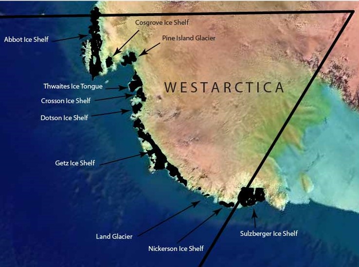
The Cosgrove Ice Shelf is a 35-mile (56 km) long by 25-mile (40 km) wide ice shelf, occupying the inner (east) part of the embayment between the King Peninsula and the Canisteo Peninsula in Westarctica.
Discovery and name
It was mapped from air photos taken by U.S. Navy Operation Highjump, 1946–47, and named by the Advisory Committee on Antarctic Names for Lieutenant Jerome R. Cosgrove, U.S. Navy Reserve, assistant communications officer on the staff of the Commander, U.S. Navy Support Force, Antarctica, during U.S. Navy Operation Deep Freeze, 1967 and 1968.