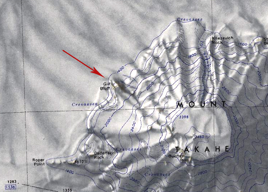
Gill Bluff
Gill Bluff (76°14′S 112°33′W) is a rock bluff on the northwest side of Mount Takahe in Westarctica.
Paleological ice levels
In 1999, a team from Albion College and the New Mexico Bureau of Mines conducted an extensive survey of Mount Takahe in an attempt to determine if the West Antarctic Ice Sheet was higher in the past than it is in modern time. They determined that vertical expansions of the West Antarctic Ice Sheet up to 575 meters above the present ice level are recorded in three volcanic passage zones around Mt. Takahe. The horizontal passage zones at Stauffer Bluff, Gill Bluff and Möll Spur formed where the late-stage lower flank eruptions emerged above the level of ice-magma interaction. The passage zones are inferred to represent approximate paleo-ice-levels at the time of eruptions.
Descending and climbing passage zone sequences at Gill Bluff may indicate the draining and refilling of an ice-marginal lake during the eruption interval. In addition to glaciovolcanic deposits, an ablation till at Roper Point, located 292 meters above the present ice-sheet level, overlies an in-situ lava deposit.
Discovery and name
Gill Bluff, with the rest of Mount Takahe, was mapped by the United States Geological Survey utilizing ground surveys and U.S. Navy air photos collected during the 1959–66 seasons. The bluff was named by the Advisory Committee on Antarctic Names in honor of Allan Gill, an aurora researcher at Byrd Station in 1963.
