Difference between revisions of "McNamara Island"
Jump to navigation
Jump to search
Westarctica (talk | contribs) (Majority of this article sourced from Wikipedia article on McNamara Island.) |
Westarctica (talk | contribs) |
||
| Line 1: | Line 1: | ||
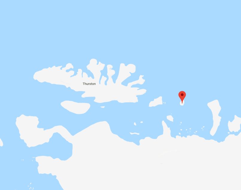
[[File:McNamaraMap.jpg|thumb|Map showing McNamara Island in relation to Thurston Island]] | [[File:McNamaraMap.jpg|thumb|400px|Map showing McNamara Island in relation to Thurston Island]] | ||
'''McNamara Island''' is a mainly ice-covered island, 11 kilometers (6 nmi) long, which is partly within the north edge of the [[Abbot Ice Shelf]] near [[Thurston Island]] about 20 nautical miles (37 km) east of [[Dustin Island]] on the extreme eastern border of [[Westarctica]]. | '''McNamara Island''' is a mainly ice-covered island, 11 kilometers (6 nmi) long, which is partly within the north edge of the [[Abbot Ice Shelf]] near [[Thurston Island]] about 20 nautical miles (37 km) east of [[Dustin Island]] on the extreme eastern border of [[Westarctica]]. | ||
Revision as of 23:24, 5 April 2018
McNamara Island is a mainly ice-covered island, 11 kilometers (6 nmi) long, which is partly within the north edge of the Abbot Ice Shelf near Thurston Island about 20 nautical miles (37 km) east of Dustin Island on the extreme eastern border of Westarctica.
Discovery and naming
It was discovered by Rear Admiral Byrd and members of the United States Antarctic Service on flights from the USS Bear on 27 February 1940. McNamara Island was named by Byrd for John McNamara, boatswain on the Jacob Ruppert of the Byrd Antarctic Expedition of 1933–35.
