Difference between revisions of "Spaulding Peninsula"
Jump to navigation
Jump to search
Westarctica (talk | contribs) (minor cleanup of links) |
Westarctica (talk | contribs) |
||
| Line 1: | Line 1: | ||
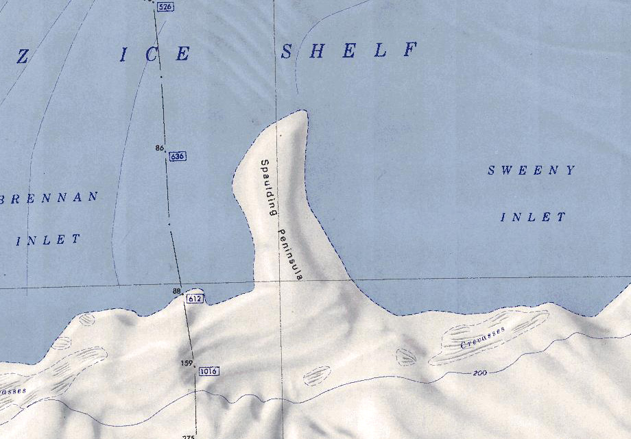
[[File: | [[File:Spaulding Peninsula.jpg|350px|thumb|Map of the Spaulding Peninsula]] | ||
The '''Spaulding Peninsula''' (74°26′S 116°0′W) is a low ice-covered peninsula west of the [[Martin Peninsula]], extending 7 nautical miles (13 km) into the [[Getz Ice Shelf]] between the Brennan Inlet and the Sweeny Inlet on the [[Bakutis Coast]] of [[Westarctica]]. | The '''Spaulding Peninsula''' (74°26′S 116°0′W) is a low ice-covered peninsula west of the [[Martin Peninsula]], extending 7 nautical miles (13 km) into the [[Getz Ice Shelf]] between the Brennan Inlet and the Sweeny Inlet on the [[Bakutis Coast]] of [[Westarctica]]. | ||
Revision as of 04:00, 6 May 2024
The Spaulding Peninsula (74°26′S 116°0′W) is a low ice-covered peninsula west of the Martin Peninsula, extending 7 nautical miles (13 km) into the Getz Ice Shelf between the Brennan Inlet and the Sweeny Inlet on the Bakutis Coast of Westarctica.
Discovery and name
It was mapped by the United States Geological Survey (USGS) using surveys and U.S. Navy aerial photographs from 1959-67. The peninsula was named by the Advisory Committee on Antarctic Names (US-ACAN) in 1977 after PRC Richard L. Spaulding, U.S. Navy, parachute-rescue team leader for Operation Deep Freeze 1977, during which he made his 1,000th career jump over the Amundsen–Scott South Pole Station. He made over 110 Antarctic jumps during his nine Deep Freeze seasonal deployments through 1977.
