Difference between revisions of "Wrigley Gulf"
Jump to navigation
Jump to search
m (fixing category) |
Westarctica (talk | contribs) (added map) |
||
| Line 1: | Line 1: | ||
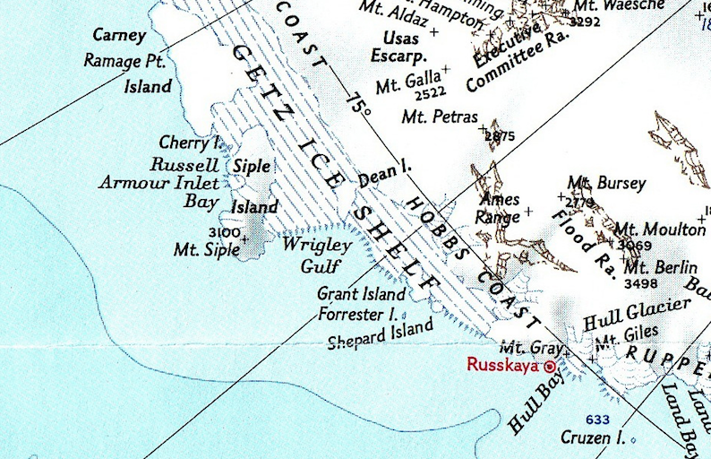
[[File:Wrigley-Gulf-Map.png|400px|thumb|Map showing location of Wrigley Gulf]] | |||
The '''Wrigley Gulf''' is an embayment (Coordinates: 74°0′S 129°0′W) about 115 miles wide along the coastline of [[Westarctica]], lying seaward of the [[Getz Ice Shelf]]. Nearly a right angle in plan, its limits are described by [[Grant Island]], [[Dean Island]], and [[Siple Island]], which are partially or wholly embedded in the ice shelf. | The '''Wrigley Gulf''' is an embayment (Coordinates: 74°0′S 129°0′W) about 115 miles wide along the coastline of [[Westarctica]], lying seaward of the [[Getz Ice Shelf]]. Nearly a right angle in plan, its limits are described by [[Grant Island]], [[Dean Island]], and [[Siple Island]], which are partially or wholly embedded in the ice shelf. | ||
Latest revision as of 08:25, 23 April 2018
The Wrigley Gulf is an embayment (Coordinates: 74°0′S 129°0′W) about 115 miles wide along the coastline of Westarctica, lying seaward of the Getz Ice Shelf. Nearly a right angle in plan, its limits are described by Grant Island, Dean Island, and Siple Island, which are partially or wholly embedded in the ice shelf.
Wrigley Gulf was discovered in December 1940 by the US Antarctic Service (USAS), and named for Philip Wrigley, a Chicago manufacturer who helped support the expedition.
