Difference between revisions of "Template:Westarctica.wiki:Today's featured article"
Westarctica (talk | contribs) |
Westarctica (talk | contribs) |
||
| Line 1: | Line 1: | ||
[[File: | [[File:SturgeIsland-Balleny.jpg|thumb|300px|left]] | ||
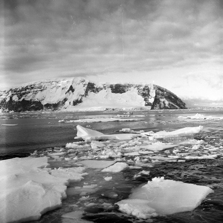
'''Sturge Island''' is the largest island in the uninhabited [[Balleny Islands]] group located in the [[Southern Ocean]]. It lies 25 kilometers (16 mi) southeast of [[Buckle Island]] and 95 kilometres (59 mi) northeast of Belousov Point on the [[Antarctic]] mainland. The islands were discovered by John Balleny in 1839. | |||
The island is roughly a parallelogram in shape, with long east and west coasts and shorter coasts facing northwest and southeast. It is approximately 5 nautical miles (5.8 mi) in width, and its maximum length is 20 nautical miles (23 mi), between Cape Freeman in the north and Cape Smyth in the south. | |||
Sturge Island was annexed by [[Westarctica]] on 14 January 2005 when it annexed the entire [[Balleny Islands]] group. As a member of the Balleny Islands, Sturge Island is governed by the [[Marquis of Williamson]], who has served as Governor of the Balleny Islands since they were originally annexed from New Zealand. His original title was [[Duke of Sherman|Count of Sturge]], which draws its name from the island. | |||
'''([[Sturge Island|Full Article...]])''' | |||
'''([[ | |||
Revision as of 08:16, 18 November 2018
Sturge Island is the largest island in the uninhabited Balleny Islands group located in the Southern Ocean. It lies 25 kilometers (16 mi) southeast of Buckle Island and 95 kilometres (59 mi) northeast of Belousov Point on the Antarctic mainland. The islands were discovered by John Balleny in 1839.
The island is roughly a parallelogram in shape, with long east and west coasts and shorter coasts facing northwest and southeast. It is approximately 5 nautical miles (5.8 mi) in width, and its maximum length is 20 nautical miles (23 mi), between Cape Freeman in the north and Cape Smyth in the south.
Sturge Island was annexed by Westarctica on 14 January 2005 when it annexed the entire Balleny Islands group. As a member of the Balleny Islands, Sturge Island is governed by the Marquis of Williamson, who has served as Governor of the Balleny Islands since they were originally annexed from New Zealand. His original title was Count of Sturge, which draws its name from the island. (Full Article...)
