Difference between revisions of "Template:Westarctica.wiki:Today's featured article"
Westarctica (talk | contribs) |
Westarctica (talk | contribs) |
||
| Line 1: | Line 1: | ||
[[File: | [[File:Mt-Berlin.jpg|thumb|300px|left]] | ||
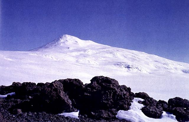
'''[[Mount Berlin]]''' is the sixth highest volcano in [[Antarctica]], located 16 km west of [[Mount Moulton]] in [[Westarctica]] near the eastern coast of the [[Ross Sea]]. It is composed of two coalesced shield volcanoes: Merrem Peak (3,000 m) and Berlin Crater (3,478 m). The volcanic structure is considered active, as steaming fumaroles have been observed near the rim of the northern and western calderas, producing fumarolic [[ice]] towers. | |||
Mount Berlin is 3,478 meters (11,411 ft) high and lies in [[Marie Byrd Land]]. It is the highest volcano in the [[Flood Range]] and the most impressive as well. [[Mount Moulton]] lies 30 kilometers (19 mi) farther east, it is a 40 kilometers (25 mi) long volcanic mountain range with ages of 5.3 million years ago. Mount Berlin lies 100 kilometers (62 mi) away from the coast. The volcano protrudes from the [[West Antarctic Ice Sheet]] and is itself covered with ice in its summit area. | |||
'''([[Mount Berlin|Full Article...]])''' | |||
'''([[ | |||
Revision as of 04:13, 4 December 2018
Mount Berlin is the sixth highest volcano in Antarctica, located 16 km west of Mount Moulton in Westarctica near the eastern coast of the Ross Sea. It is composed of two coalesced shield volcanoes: Merrem Peak (3,000 m) and Berlin Crater (3,478 m). The volcanic structure is considered active, as steaming fumaroles have been observed near the rim of the northern and western calderas, producing fumarolic ice towers.
Mount Berlin is 3,478 meters (11,411 ft) high and lies in Marie Byrd Land. It is the highest volcano in the Flood Range and the most impressive as well. Mount Moulton lies 30 kilometers (19 mi) farther east, it is a 40 kilometers (25 mi) long volcanic mountain range with ages of 5.3 million years ago. Mount Berlin lies 100 kilometers (62 mi) away from the coast. The volcano protrudes from the West Antarctic Ice Sheet and is itself covered with ice in its summit area. (Full Article...)
