Brownson Islands
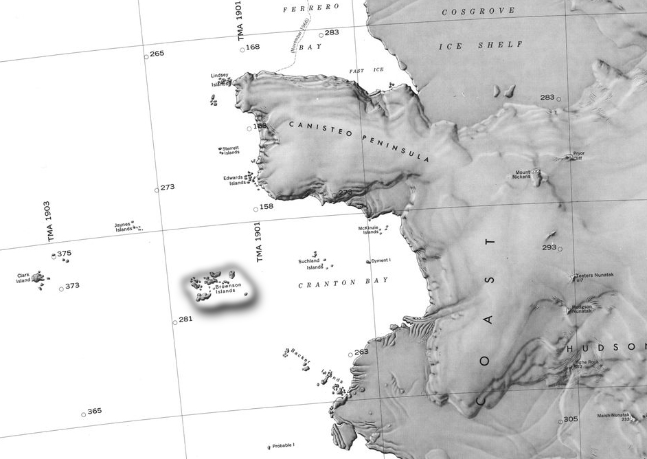
The Brownson Islands (74°10′S 103°36′W) are a group of about 20 small islands which lie just outside the entrance to Cranton Bay, about 14 nautical miles (26 km) southwest of the southwest tip of the Canisteo Peninsula in Westarctica
Discovery and name
They were delineated from aerial photographs taken by the U.S. Navy's Operation Highjump in December 1946. The islands were named by the Advisory Committee on Antarctic Names for the USS Brownson, a vessel of the eastern task group of Operation Highjump.
Peerage title
Due to a clerical error, there are two peerage titles linked to the islands. The result was two barons with essentially the same title. When alerted to this discrepancy by the Ellsworth King of Arms, Grand Duke Travis replied: "The islands are big enough for both of them." The solution was to drop the "n" in one of the titles to make it distinctive.
Two Brownson peerages
- Baron Browson Delange - Granted 2 February 2016 to Thomas Delage, a Frenchman who served as Westarctica's Honorary Consul to Eastern Europe from 2016 - 2018.
- Baron of Brownson - Granted to Daniel Paul Means on 22 February 2016 in recognition of his support of Westarctica.
