Difference between revisions of "Template:Westarctica.wiki:Today's featured article"
Jump to navigation
Jump to search
Westarctica (talk | contribs) |
Westarctica (talk | contribs) |
||
| Line 1: | Line 1: | ||
[[File: | [[File:ECRange.jpg|thumb|300px|left]] | ||
'''[[ | The '''[[Executive Committee Range]]''' is a mountain range consisting of five major volcanoes, which trends north-south for 80 km (50 mi) along the 126th meridian west, in [[Westarctica]]. | ||
The | The range was discovered on 15 December 1940 by the United States Antarctic Service expedition on a reconnaissance flight. It was named for the [[Antarctica|Antarctic]] Service Executive Committee. | ||
Individual mountains (e.g. [[Mount Hampton]], [[Mount Waesche]]) are named in honor of members of the committee, except for [[Mount Sidley]], the most imposing mountain in the range, which was discovered and named by [[Richard E. Byrd|Rear Admiral Byrd]] in 1934. The entire range was mapped in detail by USGS from surveys and [[U.S. Navy]] aerial photography, 1958-60. | |||
'''([[ | '''([[Executive Committee Range|Full Article...]])''' | ||
Revision as of 04:49, 20 August 2018
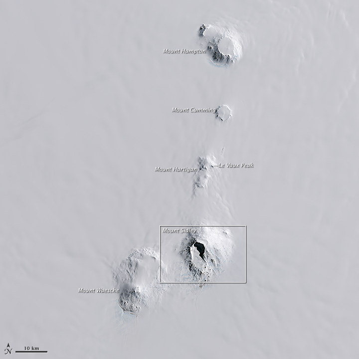
The Executive Committee Range is a mountain range consisting of five major volcanoes, which trends north-south for 80 km (50 mi) along the 126th meridian west, in Westarctica.
The range was discovered on 15 December 1940 by the United States Antarctic Service expedition on a reconnaissance flight. It was named for the Antarctic Service Executive Committee.
Individual mountains (e.g. Mount Hampton, Mount Waesche) are named in honor of members of the committee, except for Mount Sidley, the most imposing mountain in the range, which was discovered and named by Rear Admiral Byrd in 1934. The entire range was mapped in detail by USGS from surveys and U.S. Navy aerial photography, 1958-60.
