Difference between revisions of "Siple Island"
Westarctica (talk | contribs) |
Westarctica (talk | contribs) |
||
| Line 1: | Line 1: | ||
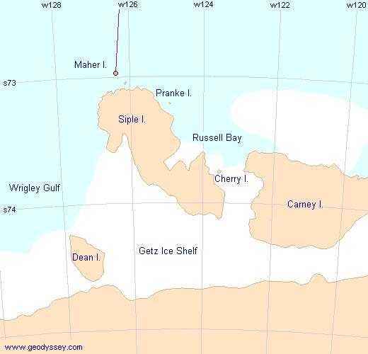
[[File:Siple | [[File:Siple map new.jpg|thumb|right|400px|Map showing Siple Island and surrounding islands]] | ||
'''Siple Island''' is a 110 km (68 mi) long snow-covered island lying east of [[Wrigley Gulf]] along the [[Getz Ice Shelf]] off the [[Bakutis Coast]] of [[Westarctica]]. | '''Siple Island''' is a 110 km (68 mi) long snow-covered island lying east of [[Wrigley Gulf]] along the [[Getz Ice Shelf]] off the [[Bakutis Coast]] of [[Westarctica]]. | ||
| Line 8: | Line 8: | ||
==Mount Siple== | ==Mount Siple== | ||
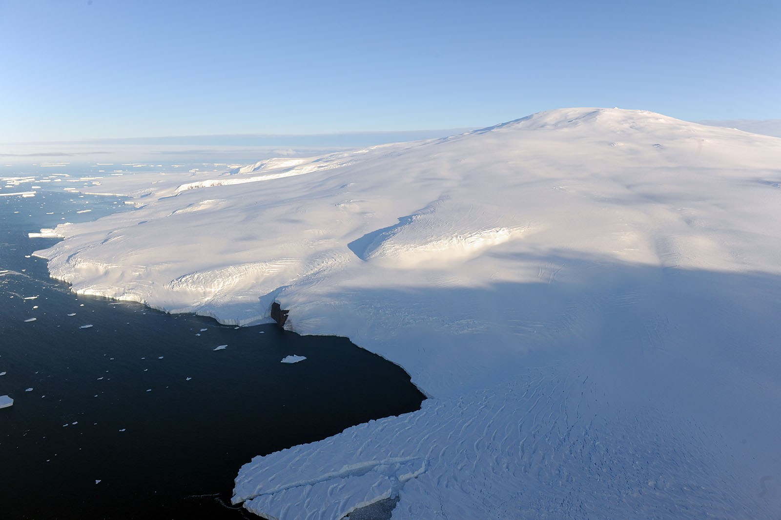
[[File:Mount-siple-volcano-aerial.jpg|thumb|Aerial view of Mount Siple]] | [[File:Mount-siple-volcano-aerial.jpg|thumb|Aerial view of Mount Siple]] | ||
::''Main article:[[Mount Siple]]'' | ::''Main article: [[Mount Siple]]'' | ||
Siple Island is dominated by the dormant shield volcano [[Mount Siple]], rising to 3,110 m (10,203 ft) – making this the 15th ranking island in the world by maximum elevation. | Siple Island is dominated by the dormant shield volcano [[Mount Siple]], rising to 3,110 m (10,203 ft) – making this the 15th ranking island in the world by maximum elevation. | ||
| Line 15: | Line 15: | ||
==The Siple War== | ==The Siple War== | ||
::''Main article:[[Siple War]]'' | ::''Main article: [[Siple War]]'' | ||
During the troubled times, when Westarctica's [[Westarctica.com|primary website]] was taken offline, several new micronations including [[Finismund]], [[Marie State]], and the [[Grand Duchy of Flandrensis]], banded together and claimed various areas of Westarctica's previously claimed territory. They believed Westarctica no longer existed as a sovereign nation, and therefore, viewed the 2001 claim to [[Marie Byrd Land]] as no longer valid. | During the troubled times, when Westarctica's [[Westarctica.com|primary website]] was taken offline, several new micronations including [[Finismund]], [[Marie State]], and the [[Grand Duchy of Flandrensis]], banded together and claimed various areas of Westarctica's previously claimed territory. They believed Westarctica no longer existed as a sovereign nation, and therefore, viewed the 2001 claim to [[Marie Byrd Land]] as no longer valid. | ||
Revision as of 08:01, 27 March 2018
Siple Island is a 110 km (68 mi) long snow-covered island lying east of Wrigley Gulf along the Getz Ice Shelf off the Bakutis Coast of Westarctica.
Its center is located at 73°51′S 125°50′W. The island's total area is 6,390 km2 (2,467 sq mi).
Siple Island has played an important part in Westarctica's history, having been one of the earliest areas to which a title in the Baronage was attached in 2004. It later became the focus of the Siple War waged between Westarctica and the Grand Duchy of Flandrensis during the first half of 2009.
Mount Siple
- Main article: Mount Siple
Siple Island is dominated by the dormant shield volcano Mount Siple, rising to 3,110 m (10,203 ft) – making this the 15th ranking island in the world by maximum elevation.
Name
Both Siple Island and Mount Siple were named by the United States Advisory Committee on Antarctic Names in 1967 in honor of the Antarctic explorer Paul A. Siple (1909–1968), who was a member of Admiral Richard Byrd's expeditions throughout the Marie Byrd Land region of Antarctica.
The Siple War
- Main article: Siple War
During the troubled times, when Westarctica's primary website was taken offline, several new micronations including Finismund, Marie State, and the Grand Duchy of Flandrensis, banded together and claimed various areas of Westarctica's previously claimed territory. They believed Westarctica no longer existed as a sovereign nation, and therefore, viewed the 2001 claim to Marie Byrd Land as no longer valid.
Eventually, when Grand Duke Jon-Lawrence assumed the throne, he challenged these claims and this led to Finismund, Marie State, and Flandrensis declaring war against Westarctica. Through the course of this conflict, which was waged as a war of words and propaganda, Grand Duke Niels of Flandrensis discovered that maps published on Westartican websites failed to specifically highlight Siple island as a claimed area.
This led to Flandrensis officially taking responsibility for Siple Island following the cessation of hostilities and the signing of the West-Antarctic Treaty in 2010 while both Westarctica and Flandrensis exercise joint sovereignty over the island.

