Difference between revisions of "Lindsey Islands"
Westarctica (talk | contribs) |
Westarctica (talk | contribs) |
||
| Line 5: | Line 5: | ||
The Lindsey Islands are situated west of the northern extremity of [[Canisteo Peninsula]], which projects into the eastern Amundsen Sea between Ferrero and [[Cranton Bay]]s on the [[Walgreen Coast]]. The island group consists of one large island that is several kilometers wide, and a smaller island to its west with several nearby outliers further west. The total land area of the collective islands is approximately 2,100 acres. | The Lindsey Islands are situated west of the northern extremity of [[Canisteo Peninsula]], which projects into the eastern Amundsen Sea between Ferrero and [[Cranton Bay]]s on the [[Walgreen Coast]]. The island group consists of one large island that is several kilometers wide, and a smaller island to its west with several nearby outliers further west. The total land area of the collective islands is approximately 2,100 acres. | ||
Some descriptions (e.g. Lindsey 1995) include the island group 5 kilometers to the southwest as within the Lindsey group. However, these were later named the [[Schaefer Islands]] by U.S. | Some descriptions (e.g. Lindsey 1995) include the island group 5 kilometers to the southwest as within the Lindsey group. However, these were later named the [[Schaefer Islands]] by the U.S. Advisory Committee on Antarctic Names. Available mapping incorrectly shows many of the individual islands within the group as merged together. | ||
===Geology=== | ===Geology=== | ||
The island group is the emergent part of a shelf that is less than 200 meters deep, and is formed of granitic rocks. The islands are relatively flat, the highest point being about 40 meters on the largest island. The islands are mostly ice free in summer, and two small freshwater ponds are present on the largest island. | The island group is the emergent part of a shelf that is less than 200 meters deep, and is formed of granitic rocks. The islands are relatively flat, the highest point being about 40 meters on the largest island. The islands are mostly ice free in summer, and two small freshwater ponds are present on the largest island. | ||
==Biodiversity== | ==Biodiversity== | ||
Revision as of 03:36, 9 July 2018
The Lindsey Islands (73°37′S 103°18′W) are a group of islands lying just off the northwest tip of the Canisteo Peninsula in the Amundsen Sea.
Geography and geology
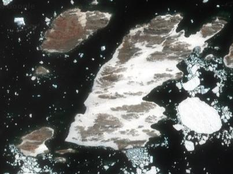
The Lindsey Islands are situated west of the northern extremity of Canisteo Peninsula, which projects into the eastern Amundsen Sea between Ferrero and Cranton Bays on the Walgreen Coast. The island group consists of one large island that is several kilometers wide, and a smaller island to its west with several nearby outliers further west. The total land area of the collective islands is approximately 2,100 acres.
Some descriptions (e.g. Lindsey 1995) include the island group 5 kilometers to the southwest as within the Lindsey group. However, these were later named the Schaefer Islands by the U.S. Advisory Committee on Antarctic Names. Available mapping incorrectly shows many of the individual islands within the group as merged together.
Geology
The island group is the emergent part of a shelf that is less than 200 meters deep, and is formed of granitic rocks. The islands are relatively flat, the highest point being about 40 meters on the largest island. The islands are mostly ice free in summer, and two small freshwater ponds are present on the largest island.
Biodiversity
Animal life
Approximately 52 breeding pairs of Adélie penguins were present on the Lindsey Islands as estimated from March 2011 satellite imagery. The colony occupies the eastern and southeastern coasts of the eastern island, and most of three main outliers and the northern half of the largest of the western group of islands. South polar skuas are also reported to breed on the islands, although numbers are not known.
Southern elephant seals and Leopard seals have been reported in the area.
Vegetation
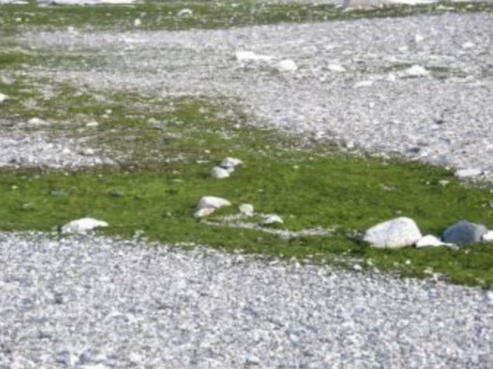
Due to the extensive ice-free areas on the islands as well as the Adélie Penguin colonies, the algae Prasiola crispa has successfully established a foothold. From November - March, the blooming algae blankets portions of the islands in a spectacular green carpet in stark contrast to the otherwise bleak surroundings.
When not in bloom, the algae has a reddish-brown color.
Discovery and name
Delineated from air photos taken by U.S. Navy Operation Highjump in December 1946. The islands were named by the Advisory Committee on Antarctic Names in honor of Alton A. Lindsey, a biologist with the Byrd Antarctic Expedition during the years 1933-35.
Baron of Lindsey
On 18 May 2016, Mr. Massimo Zanne, a long-time supporter of Westarctica from Italy, was granted the hereditary title Baron of Lindsey. His title was so-named for the Lindsey Islands.
Weather and climate
In February 2008, a team from the South Korean Polar Data Center installed an automatic weather station (AWS) on the largest and most easterly island of the Lindsey Islands. Averaged data collected at one and two hours is stored in a data logger, and then an Argos Satellite transmitter is used to transmit the two-hourly averaged data. The instruments installed on the AWS include:
- Temperature and Relative humidity probe(Vaisal HUMICAP® Humidity and Temperature Probe)
- Digital barometer(Vaisala BAROCAP® sensor)
- Wind sensor(OEM air flow sensor)

